Download Here
Company to Deploy its Next Generation Lane-Based Tolling System on a Major Express Lane Corridor
Machine Learning, Cloud, and Dynamic Pricing Capabilities Deliver Superior Travel and Future-Ready Scalability
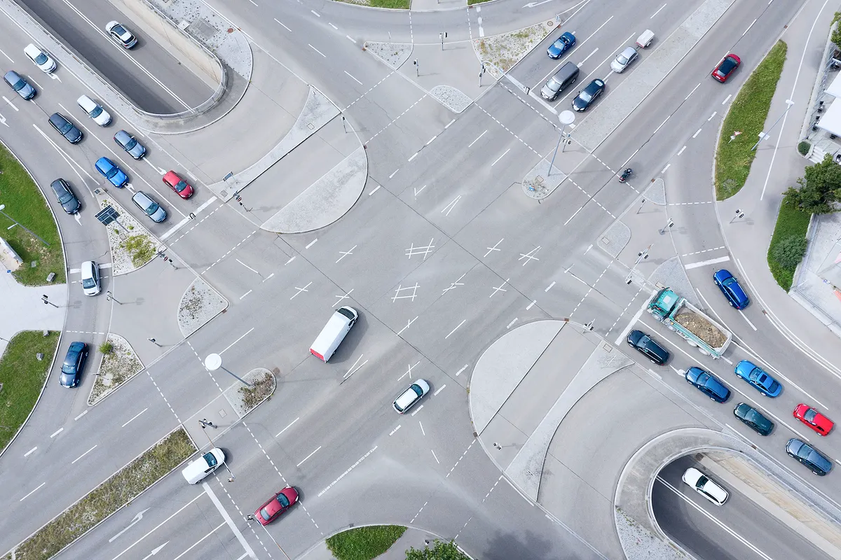
TORONTO, Nov. 19, 2025 /PRNewswire/ - Quarterhill Inc. ("Quarterhill" or the "Company") (TSX: QTRH) (OTCQX: QTRHF), a leading global provider of intelligent transportation system ("ITS") solutions, today announced a $5.2 million contract to deploy its Next Generation Toll Lane System on a major U.S. express lane corridor. The contract, with an existing tolling customer, underscores Quarterhill's capabilities to modernize roadway technology, implement dynamic pricing, and seamlessly automate tolling operations for major transportation agencies.
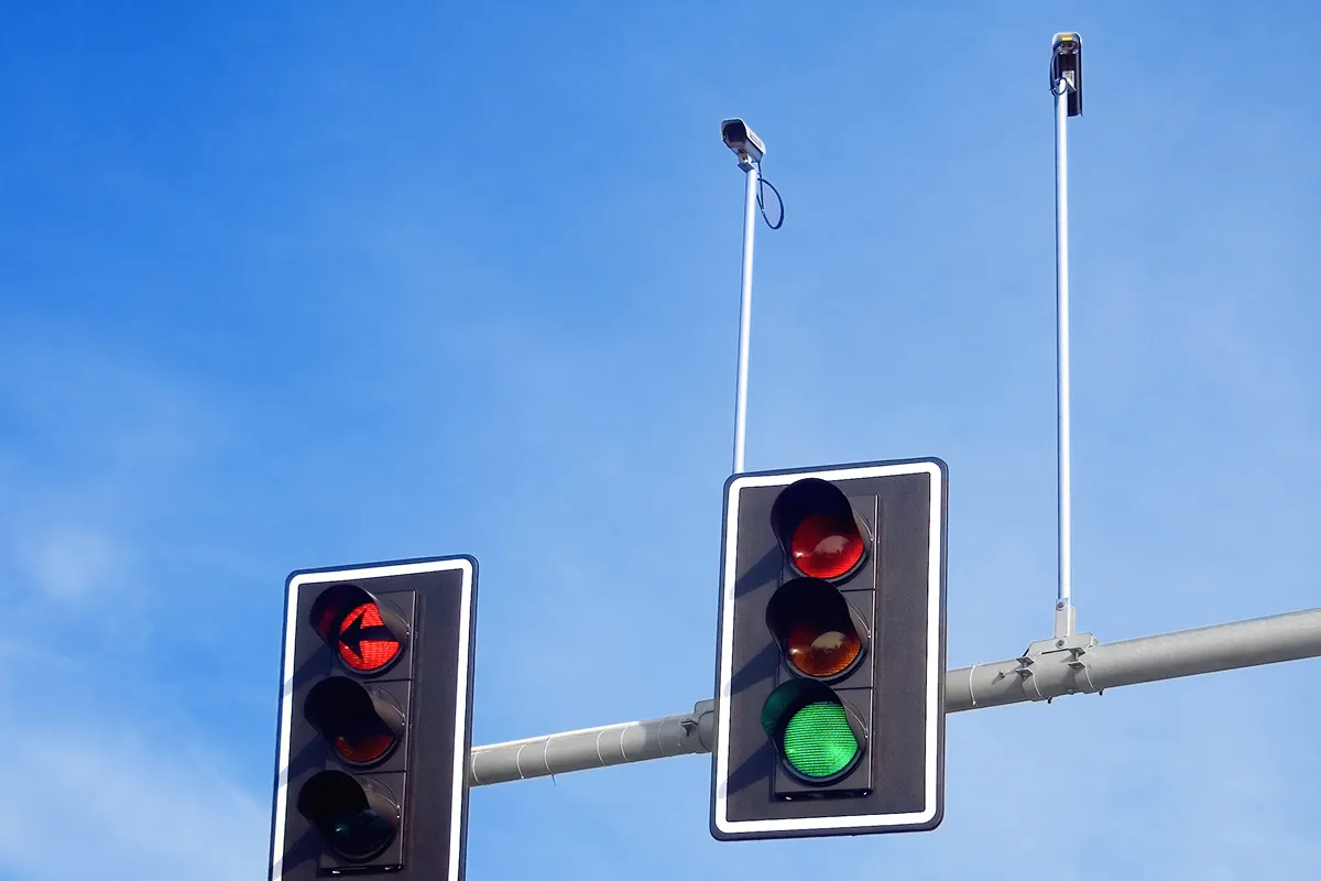
The new system introduces real-time traffic condition monitoring, advanced video technology, machine learning-driven tolling automation, and dynamic pricing capabilities designed to improve traffic flow, optimize lane use, and enhance driver experience. Building upon the foundation of an existing system by Quarterhill, this upgrade involves seven toll zones, delivering greater flexibility and accuracy in toll collection while leveraging an already-operational cloud-based toll host for future scalability.
"This project represents the future of intelligent mobility," said Quarterhill CEO Chuck Myers. "By combining machine learning-powered vehicle detection, real-time data, and cloud technology, we're helping agencies deliver safer, faster, and more reliable travel for every driver while creating a smarter, more adaptable tolling system for the state."
Key enhancements of the Next Generation Toll Lane System include:
- Machine Learning & Automation – Machine learning and advanced sensors for highly accurate automated vehicle detection, classification and trip building.
- Cloud Migration – Modern, secure back-office infrastructure enabling scalable operations and simplified maintenance.
- Dynamic Pricing – Express lane tolls that automatically adjust based on live traffic conditions to maintain free-flow speeds.
- Upgraded Readers & Cameras – High-definition imaging and sensor technology for precise, real-time monitoring.
This initiative reinforces Quarterhill's commitment to helping agencies modernize tolling infrastructure, reduce congestion, and improve roadway safety. The initiative strengthens the Company's longstanding partnerships and demonstrates how its technology can enhance mobility across diverse transportation networks to benefit travelers.
For more information, please visit Quarterhill.com.
About Quarterhill
Quarterhill is a global leader in the Intelligent Transportation System (ITS) industry, advancing mobility through smart infrastructure solutions that reduce congestion, improve roadway safety, and create more sustainable travel. Each year, Quarterhill's platforms process billions of transactions, perform compliance and safety inspections on millions of commercial vehicles, and enable transportation agencies worldwide to optimize thousands of lanes of traffic to improve travel for everyone. Leveraging advanced artificial intelligence and machine learning technologies, Quarterhill's platform delivers automation and predictive insight to help agencies manage transportation networks more efficiently. By working in close partnership with governments, communities, and industry leaders, Quarterhill is building today's connected roadways while shaping the next generation of intelligent, resilient mobility. Quarterhill is listed on the TSX under the symbol QTRH and on the OTCQX Best Market under the symbol QTRHF. For more information, please visit: www.quarterhill.com
Forward-looking Information
This news release contains forward-looking information and forward-looking statements within the meaning of applicable Canadian securities laws (collectively, "forward-looking statements"). Such forward-looking statements relate to future events, conditions or future financial performance of Quarterhill based on future economic conditions and courses of action. All statements other than statements of historical fact may be forward-looking statements. Such forward-looking statements are often, but not always, identified by the use of any words such as "seek", "anticipate", "budget", "plan", "goal", "expect" and similar expressions.
Forward-looking statements involve known and unknown risks, assumptions, uncertainties and other factors that may cause actual results or events to differ materially from those anticipated in such forward-looking statements. Material risk factors that could cause actual results to differ materially from the forward-looking statements contained in this news release include, among others, demand for Quarterhill's products and services; general economic and market conditions; competition; risks relating to technological advances and cyber-security; and other risks set forth in the Company's most recent annual information form available on SEDAR+ at www.sedarplus.ca. The Company believes the expectations reflected in the forward-looking statements are reasonable, but no assurance can be given that these expectations will prove to be correct and such forward-looking statements included in this news release should not be unduly relied upon. Material factors and assumptions used to develop the forward-looking statements contained in this news release include, among others: Quarterhill's ability to execute on its business plan; demand for Quarterhill's products and services; operating assumptions; and financial projections and cost estimates. Quarterhill has no intention, and undertakes no obligation, to update or revise any forward-looking statements, whether as a result of new information, future events or otherwise, except as required by law.
View original content:https://www.prnewswire.com/news-releases/quarterhill-announces-5-2-million-contract-with-existing-tolling-customer-302619337.html
SOURCE Quarterhill Inc.